Travel Tips
The Sulayr Trail in the Sierra Nevada.
Published September 16, 2025 | Categories: Travel Tips, Nature & Environment
TL;DR: The Sulayr Trail (GR-240) is Spain’s longest circular hiking route. With 300 km across 60 villages and breathtaking Sierra Nevada landscapes, it’s a must for outdoor lovers visiting Andalusia.
The Sulayr Trail, Sierra Nevada: 300 km Circular Route Through 60 Villages
Table of Contents
- What is the Sulayr Trail?
- Landscapes and Elevation
- Villages Along the Route
- Trail Logistics and Signage
- Best Season to Hike
- Practical Tips for Hikers
- Cultural and Environmental Value
What is the Sulayr Trail?
The Sulayr Trail in the Sierra Nevada (GR-240) is a 300 km circular route that surrounds the Sierra Nevada massif in Andalusia. The name “Sulayr” means “Mountain of the Sun,” a term given by the Arabs who once inhabited the region. This unique trail, divided into 19 stages, is the longest circular hiking path in Spain and combines high-altitude trekking with immersion in traditional mountain life.
Origin of the Name
The name Sulayr comes from the Arabic word Šuláyr, used during the period of Al-Andalus to refer to the Sierra Nevada. It translates as “Mountain of the Sun”, reflecting both the region’s Arabic heritage and the dazzling sunlight that characterizes the high peaks of Andalusia. The trail’s modern designation pays tribute to this historical legacy while celebrating the natural beauty of the mountain range.
Landscapes and Elevation
The route runs at an average elevation between 1,800 and 2,000 meters, traversing meadows, rivers, forests, and valleys that form the core of the Sierra Nevada ecosystem. Hikers encounter diverse flora and fauna, with habitats ranging from alpine grasslands to oak and pine woods. The trail also offers stunning views of the Alpujarra hills, the Marquesado plain, and distant Mediterranean horizons.
Villages Along the Route
One of the highlights of the Sulayr is its connection to 60 villages across six regions. These include gems such as Trevélez, famous for its cured ham, and Capileira, known for whitewashed houses and traditional architecture. The trail also links to villages like Válor, Dílar Valley, Lecrín, and others, where hikers can enjoy authentic Andalusian hospitality, gastronomy, and cultural heritage. For visitors staying in Towns & Villages across Almería and Granada, the Sulayr provides a direct gateway into mountain life.
Trail Logistics and Signage
The Sulayr Trail is officially marked as GR-240, with white and red blazes, interpretive panels, and access points from nearby towns. While some hikers take on the full 300 km, most choose to complete individual stages depending on time and fitness. The route is challenging yet accessible, making it suitable for experienced trekkers as well as casual hikers who want shorter day trips.
Best Season to Hike
The recommended season for hiking is summer and early autumn, when snow has melted from most sections. In winter and spring, parts of the route may remain snow-covered, requiring proper equipment and preparation. Each season offers different charms: alpine flowers in late spring, long clear days in summer, and autumn colors in the valleys.
Practical Tips for Hikers
- Carry sufficient water and sun protection, as high-altitude weather can be unpredictable.
- Wear layered clothing to adapt to sudden temperature changes.
- Plan overnight stays in mountain villages or refuges along the way.
- Check conditions with the Sierra Nevada National Park authority before starting.
- Remember that some sections are far from populated areas, so preparation is key.
Cultural and Environmental Value
The Sulayr is more than a hiking path: it symbolizes the unity of two provinces, six regions, and sixty municipalities. It is the backbone of Sierra Nevada’s trail network and a vital link between Nature & Environment conservation and local traditions. By walking the Sulayr, visitors not only enjoy breathtaking views but also support rural communities and sustainable tourism in Andalusia.
For more updates from across the province, visit our Travel Tips category.
Travel Tips
Almeria City Guide. Discover Almeria City — Culture, Cuisine, History & Mediterranean Life
Published October 27, 2025 | Category: Travel Tips
TL;DR: Almeria City is where the desert meets the Mediterranean — a bright, historic port full of Moorish charm, authentic tapas bars, sustainable innovation, and endless Andalusian sunshine.
Almeria City Guide. What to do in Almeria
Table of Contents
- Introduction
- History & Heritage
- Districts & Urban Life
- Top Attractions
- Walking Routes & Viewpoints
- Museums & Cultural Spaces
- Food, Tapas & Wine
- Port, Sustainability & Innovation
- Festivals & Nightlife
- Beaches & Nature
- Street Markets & Local Life
- Day Trips from Almeria City
- How to Get There
- Practical Information
Introduction
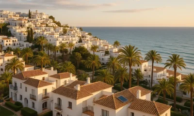
Bathed in light for more than 3,000 hours a year, Almeria City stands at the meeting point of desert and sea. Between the Mediterranean horizon and the dry hills of the Sierra de Alhamilla, it’s a city that blends Moorish architecture, relaxed Andalusian living, and striking modern contrasts. Compact, walkable, and full of colour, Almeria is the perfect base for discovering southeastern Spain.
The atmosphere is friendly and unhurried. People still greet each other in the streets, café terraces are filled even in winter, and the scent of the sea drifts through the old town. Every corner of Almeria feels both deeply local and unexpectedly cosmopolitan.
History & Heritage
Founded in the 10th century by Abd-ar-Rahman III as the fortified port of the Caliphate of Cordoba, Almeria — from Al-Mariyya, “the watchtower” — quickly became one of Al-Andalus’s key trading hubs. Its prosperity attracted merchants, poets and artisans whose legacy still shapes the old town today.
The Alcazaba of Almeria, a vast citadel rising above the city, remains one of Spain’s largest Islamic fortresses. After centuries of earthquakes, pirate raids and wars, the fortress was restored to its original grandeur and offers sweeping views of the port and sea. Nearby, the 16th-century Cathedral of Almeria blends Gothic, Renaissance and defensive architecture — a church built to withstand corsairs.
Through the 19th century Almeria thrived again on mining and trade. Later, the surrounding desert became a backdrop for classic Western films like The Good, the Bad and the Ugly. The film legacy continues today in Mini Hollywood and the annual FICAL Film Festival.
Districts & Urban Life
The historic centre, or Casco Histórico, is a maze of narrow Moorish streets that open onto elegant 19th-century boulevards. The Paseo de Almeria is the city’s main artery, lined with cafés and boutiques, while Puerta Purchena serves as the main meeting point for locals.
Under the Alcazaba lies La Chanca-Pescadería, a neighbourhood painted in pastel colours where fishermen once lived — still a favourite spot for photographers. Eastwards stretch the modern districts of Nueva Almeria and Retamar, home to beach apartments and the University Campus. Each part of the city carries a different rhythm, from student bustle to evening paseo elegance.
Top Attractions
Start with the Alcazaba, exploring its towers and gardens before descending to the cathedral square. Visit the Civil War Shelters — four kilometres of underground tunnels now open to visitors — and the Museo de Almeria, showcasing artefacts from prehistoric Los Millares to Roman mosaics.
For art, the Doña Pakyta Museum displays early 20th-century Andalusian painters, while the Centro Andaluz de la Fotografía holds rotating exhibitions. End your afternoon at Paseo Marítimo Carmen de Burgos, where the sea breeze and palm trees create a relaxed promenade atmosphere.
Walking Routes & Viewpoints
Almeria rewards walkers. Begin at the Cathedral and follow Calle Real up through La Chanca to reach the Alcazaba Viewpoint, with panoramic views over terracotta rooftops and the harbour. Continue to Cerro San Cristóbal for a broader panorama — especially stunning at sunset.
For a gentle city walk, trace the Rambla de Belén park from Puerta Purchena down to the seafront — a 30-minute stroll lined with fountains and jacarandas. Cyclists and runners favour the Paseo Marítimo, stretching several kilometres east towards El Toyo. Each route reveals how sea and desert coexist in daily life.
Museums & Cultural Spaces
Culture thrives in Almeria. Beyond its main museums, the Teatro Apolo hosts local theatre and flamenco shows, while the Auditorio Maestro Padilla stages orchestras and international festivals by the sea. The Almeria Art Centre inside a restored warehouse offers modern exhibitions and workshops.
Film heritage also runs deep — visit the small Casa del Cine, once the residence of John Lennon during the filming of How I Won the War, where he began writing “Strawberry Fields Forever”.
Food, Tapas & Wine in Almeria City
Named Spain’s Gastronomic Capital in 2019, Almeria keeps tapas culture alive: order a drink, get a free dish. It’s an essential local ritual — lively, social, and endlessly diverse.
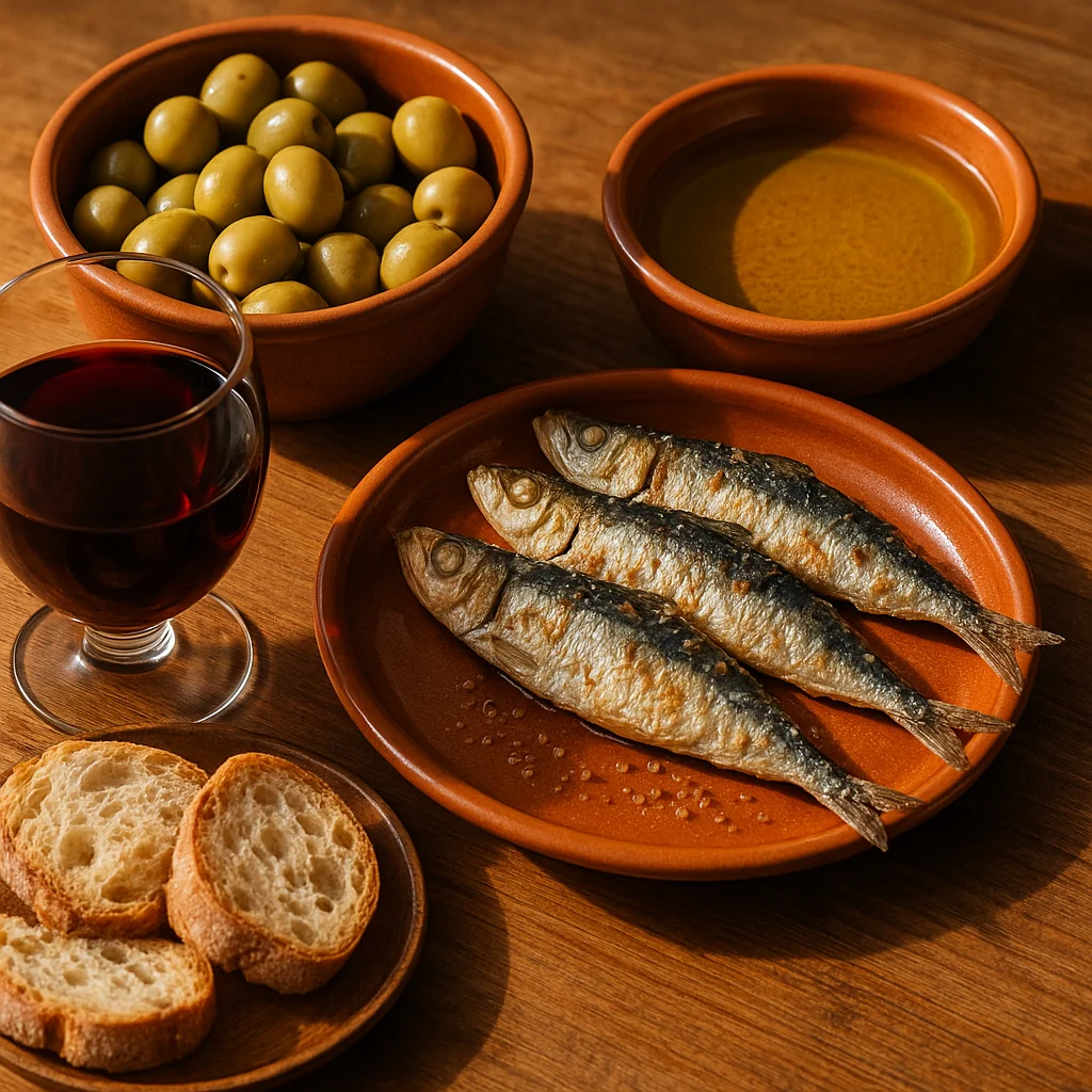
Tapas range from simple olives and anchovies to seafood stews, gurullos with rabbit, and grilled sardines caught that morning.
Head to Plaza Vieja or Calle Jovellanos for classics like Casa Puga, serving local wine and jamón ibérico since 1870. Around the Paseo Marítimo, beachside bars such as La Mala and Marhaba mix creative Mediterranean cuisine with sunset views. Every spring, the city hosts the Ruta de la Tapa de Almeria, where dozens of bars compete for the title of best tapa.
Almeria’s surrounding valleys produce excellent wines — especially from Laujar de Andarax and Ohanes — as well as extra-virgin olive oils, goat cheeses, and vegetables grown under the region’s famous greenhouses. Locals proudly say the province feeds Europe, yet the best produce still ends up on their own tables.
Port, Sustainability & Innovation
The Port of Almeria is both a gateway and a symbol of renewal. From ferries to Melilla and North Africa to fishing boats and cruise ships, the harbour remains vital to the city’s identity. In recent years, it has also become a pioneer in environmental management, introducing solar-powered facilities, shore-side electricity, and waste-reduction systems to cut maritime pollution.
Just east of the port, innovation meets ecology. Local researchers and startups are transforming plastic waste from the agricultural industry into fuel — a project that’s gained international attention. Learn more about this initiative in our feature Plastic to Biodiesel in Almeria.
Combined with regional solar farms and sustainable greenhouse practices, Almeria is quietly positioning itself as one of Spain’s leading hubs for clean energy and circular economy innovation.
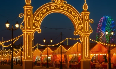
Festivals & Nightlife
Each August the Feria de Almeria transforms the city with music, parades and fireworks honouring the Virgen del Mar. Earlier in the year, Semana Santa processions fill the old town with candles and drums, while November brings the International Film Festival (FICAL) celebrating Almeria’s cinematic legacy.
As night falls, Almeria comes alive with terrace bars, open-air concerts and flamenco shows in venues like Peña El Taranto. The student population keeps the nightlife vibrant, especially around Plaza Masnou and the seafront. It’s a safe, walkable city where locals linger late into the night over wine and conversation.
Beaches & Nature
Within city limits, El Zapillo and San Miguel beaches are lively and family-friendly, while Retamar and El Toyo near the airport offer quieter sands and boardwalks.
To the east, the volcanic cliffs of Cabo de Gata Natural Park unfold with hidden coves such as Monsul and Genoveses — easily reached by car or bus.
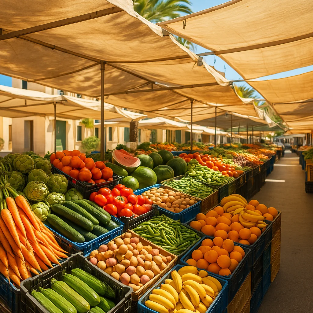
Street Markets & Local Life in Almeria City
Almeria’s mercadillos bring colour and rhythm to every neighbourhood. Open a market below to see key details (day, hours, location, stalls).
Mercadillo del Estadio de los Juegos Mediterráneos (Tue)
| Details | Information |
|---|---|
| Market day | Tuesday |
| Type | General goods market |
| Location | Calle del Acebo, near the Estadio de los Juegos Mediterráneos |
| Hours | 08:30 – 14:00 |
| Stalls | ≈ 320 |
One of the largest markets in Almeria, with clothing, shoes, produce, plants and household goods.
Mercado de la Plaza Pavía (Mon–Sat)
| Details | Information |
|---|---|
| Market days | Monday – Saturday |
| Type | General goods & produce market |
| Location | Plaza Pavía, city centre |
| Hours | 09:00 – 14:00 |
Main covered market with fresh fish, fruit and vegetables; busiest in the morning.
Mercadillo de Cabo de Gata (Sat)
| Details | Information |
|---|---|
| Market day | Saturday |
| Type | General goods market |
| Location | Plaza Malvasía, Cabo de Gata |
| Hours | 08:30 – 14:00 |
| Stalls | ≈ 30 |
Small, friendly seaside market—great to pair with a beach walk.
Mercadillo de El Alquián (Sun)
| Details | Information |
|---|---|
| Market day | Sunday |
| Type | General goods market |
| Location | Ctra. Níjar – El Alquián, near Almeria Airport |
| Hours | 08:30 – 15:00 |
| Stalls | ≈ 115 |
Lively Sunday market popular with families and bargain hunters.
Mercadillo de Los Ángeles (Fri)
| Details | Information |
|---|---|
| Market day | Friday |
| Type | General goods market |
| Location | Calle Vecina Concha Ruiz, Los Ángeles district |
| Hours | 08:30 – 14:00 |
| Stalls | ≈ 265 |
Traditional neighbourhood market known for textiles and household items.
Mercadillo de la Bola Azul (Mon)
| Details | Information |
|---|---|
| Market day | Monday |
| Type | General goods market |
| Location | Calle Haza de Acosta, Bola Azul area |
| Hours | 08:30 – 14:00 |
| Stalls | ≈ 200 |
Close to the hospital zone; handy for everyday shopping and fresh produce.
Mercado del Auditorio Maestro Padilla (Sat)
| Details | Information |
|---|---|
| Market day | Saturday |
| Type | General goods market |
| Location | Auditorio Maestro Padilla, seafront zone |
| Hours | 08:30 – 14:00 |
| Stalls | ≈ 230 |
By the sea near the auditorium—great weekend vibe for families and photographers.
Set beside the sea near the auditorium, this Saturday market combines ocean views with a lively weekend vibe — perfect for families and photographers alike.
Together these markets form the heartbeat of Almeria’s social life: a weekly meeting place full of colour, aromas, and Mediterranean character.
Day Trips from Almeria City
Within an hour you can explore extraordinary landscapes and villages:
- Tabernas Desert — Europe’s only desert, known for its western film sets and dramatic canyons.
- Níjar Village — famous for pottery, woven rugs and whitewashed alleys.
- Cabo de Gata Beaches — unspoilt coves such as Monsul, Media Luna and Genoveses.
- Alpujarra Almeriense — mountain villages like Laujar de Andarax surrounded by vineyards and chestnut forests.
- Roquetas de Mar — a resort town west of the capital with a long promenade and water-sports facilities.
All destinations are reachable by car or organised excursion, making Almeria a perfect hub for slow travellers.
How to Get to Almeria City
Almeria City is easily accessible by all major routes in southeastern Spain. The Almeria Airport (LEI) lies just 9 km east of the city centre, with regular flights to Madrid, Barcelona and several European destinations. Buses and taxis connect the airport with the main station area at Plaza de las Velas.
Long-distance buses link Almeria with Granada, Malaga, Murcia and Madrid, while regional trains connect with destinations along the coast. The port also serves regular ferry routes to Melilla and North Africa.
Inside the city, local buses cover most neighbourhoods, and the compact layout makes it easy to explore on foot or by bike along the Paseo Marítimo and Rambla avenues.
Practical Information
- Region: Capital of Almeria Province, southeastern Spain.
- Municipal info: Ayuntamiento de Almeria — services, events and notices.
- Tourist Office: Plaza de la Constitución | +34 950 210 538
- Transport: Airport (LEI) 9 km; bus & train station near Plaza de las Velas; ferry links to Melilla and North Africa.
- Emergency numbers (Spain): 112 (General) · 061 (Medical) · 062 (Guardia Civil) · 085 (Fire)
For a province-wide overview of upcoming festivities and public holidays, check the
official Almeria Local Holidays 2026 calendar, which includes all major events across the region.
For more updates from across the province, visit our Towns & Villages category.
Travel Tips
Alicun Guide. Discover Alicun, Almeria — Nature, Heritage & Valley Tranquillity
Published October 23, 2025 | Category: Travel Tips
TL;DR: Alicun is a peaceful Andarax valley village in Almeria, known for its olive groves, mountain scenery and authentic Andalusian rhythm — perfect for slow travel, short hikes and rural discovery.
Alicun Guide. Discover Alicun, Almeria — Nature, Heritage & Valley Tranquillity
Table of Contents
- Introduction
- History & Heritage
- Nature & Surroundings
- Culture & Local Life
- Festivals & Events
- Local Market
- Getting There & Accommodation
- Travel Tips
Introduction: A valley village with deep rural roots
Nestled in the lower Andarax valley between the Sierra de Gador and Sierra Alhamilla, Alicun offers a picture of traditional Andalusian village life. With around 250 inhabitants, it’s one of the smallest municipalities in the province of Almeria — quiet, authentic, and surrounded by olive groves and almond fields that paint the hillsides each spring.
Despite its size, Alicun maintains its own Ayuntamiento (town hall), local festivities, and a handful of family-run bars and shops that cater to residents and weekend visitors. The village’s position near the Diputación de Almería network of rural routes makes it a pleasant stop for walkers exploring the Andarax basin.
History & Heritage
Alicun’s origins trace back to Moorish Al-Andalus, when irrigation channels transformed these dry foothills into fertile farmland. Like other Andarax towns, it witnessed repopulation after the Morisco expulsion and gradual adaptation to the valley’s microclimate. Today, the village preserves its traditional street layout — narrow, whitewashed lanes leading to small squares where the church tower overlooks the rooftops.
The heart of Alicun is defined by the Iglesia de San Sebastián, a 19th-century parish built over earlier foundations. Around it, you’ll find traces of traditional architecture with stone façades and wooden balconies, reflecting rural craftsmanship that still survives in older homes.
Nature & Surroundings
Alicun sits on the fertile banks of the Andarax River, which nourishes its groves of olive, orange, and almond trees. Walking paths link the village to neighbouring towns like Alhabia and Alhama de Almeria, offering scenic views of the valley and the Sierra de Gador’s reddish slopes.
For outdoor enthusiasts, short circular routes follow irrigation ditches and hillside tracks, while longer hikes ascend into the nearby mountains. Spring is especially beautiful, when almond blossoms turn the valley pale pink and white.
Culture & Local Life
Life in Alicun moves at a gentle pace. Mornings start early, with locals gathering for coffee in the plaza or tending to smallholdings. Traditional festivals, local markets, and community meals punctuate the year — offering visitors a warm introduction to authentic inland Almeria.
Although the village is small, residents take pride in maintaining long-standing customs and religious processions, particularly those tied to the local patron saint and harvest season.
Festivals & Events
Alicun celebrates two main fiestas locales each year:
- 20 January — Local holiday (Fiesta de San Sebastián, the town’s patron saint).
- 26 August — Local holiday marking the summer celebrations with music, games, and traditional events.
Visitors during these dates will find the streets filled with music, stalls, and local food, as families and neighbours celebrate in the heart of the village.
For a province-wide overview of upcoming festivities and public holidays, check the
official Almeria Local Holidays 2026 calendar, which includes all major events across the region.
Mercadillo de Alicun
While Alicun itself does not host a large weekly market, residents often visit nearby Alhabia or Alhama de Almeria on market days (Monday and Friday respectively). These markets offer fresh produce, clothing, and local goods — ideal for experiencing the valley’s community life.
Getting There & Accommodation
By car: Alicun lies about 30 km from Almeria city. Take the A-92 and turn off toward Alhama de Almeria, following signs into the valley. Parking is free and easy around the village entrance.
By bus: Limited regional services connect Alicun with nearby towns — check schedules in advance.
Stay: Accommodation options include small rural houses (casas rurales) and guest rooms in neighbouring villages like Alhama or Alhabia.
Travel Tips
- Visit in spring to see the almond blossoms and mild weather.
- Bring walking shoes — most village streets are cobbled and hilly.
- Try local olive oil and almonds sold directly by residents.
Practical Information
- Region: Lower Andarax valley, between Sierra de Gador and Sierra Alhamilla.
- Municipal info: Ayuntamiento de Alicun — contacts, notices and local services.
- Stats & map: Junta de Andalucía — SIMA municipal fiche for Alicun (geographical and demographic data).
- Nearby towns: Alhabia (2.5 km) and Alhama de Almeria (7 km), both accessible via local roads through the valley.
- Tourist info: Diputación de Almería — provincial tourism and cultural resources.
- Emergency numbers (Spain): 112 (General) · 061 (Medical) · 062 (Guardia Civil) · 085 (Fire)
For more village destinations across the province, visit our Towns & Villages.
Travel Tips
Alhama de Almeria Guide. Thermal Springs, History & Valley Life
Published October 23, 2025 | Category: Travel Tips
TL;DR: Alhama de Almeria is a historic thermal-spring village in the lower Andarax valley, set between the Sierra de Gador and Sierra Alhamilla — a calm base for easy walks, spa time and authentic inland life.
Discover Alhama de Almeria — Thermal Springs, History & Valley Life
Table of Contents
- Introduction
- History & Heritage
- Nature & Walking Trails
- Thermal Springs & Wellbeing
- Culture & Local Life
- Gastronomy
- Festivals & Events
- Getting There & Accommodation
- Itineraries & Day Trips
- Practical Information
Introduction: Valley town between two mountain chains
Set in the fertile lower Andarax valley, Alhama de Almeria sits where citrus and olive groves spread between the Sierra de Gador to the west and the Sierra Alhamilla to the east. The municipality keeps an active town hall and services while retaining a small-town rhythm — white façades, a compact center and green huertas irrigated by historic channels. For official contacts and notices, consult the Ayuntamiento de Alhama de Almeria.
History & Heritage
Alhama’s name links to “thermal waters,” and the village has long been known for its hot springs and as a strategic valley settlement. The wider municipality preserves Copper-Age and protohistoric remains — including megalithic necropolises and fortified sites — and later civil heritage such as the neoclassical bridge known as La Puente and the 19th-century spa building itself.
Strolling the historic core reveals terraced lanes, the parish church and houses that still trace water-wise urbanism. Heritage information is periodically published via regional inventories and the town hall channels; for statistical and cartographic context, see the Junta’s SIMA municipal fiche.
Nature & Walking Trails
The river Andarax creates a ribbon of green habitat through otherwise semi-arid foothills. From town you can take flat riverside loops along farm tracks and poplar stands, or climb low ridges for views to Gador and Alhamilla. The valley’s microclimate offers mild winters and dry summers; spring and autumn are prime for easy hikes and cycling between villages.
A classic half-day combines a gentle walk among orchards, a viewpoint at golden hour and a relaxed tapas stop back in the center. Longer day routes link neighboring Andarax villages by quiet lanes and farm roads. (Always carry water and sun protection.)
Thermal Springs & Wellbeing
Alhama’s signature is its historic spa tradition. The Balneario San Nicolás (Hotel-Spa) sits by the valley at the base of Sierra de Gador and channels natural mineral-medicinal waters — a tradition documented for centuries and housed in the 19th-century complex you see today. For treatments, day access and seasonal opening details, consult the official spa site: Balneario San Nicolás.
Culture & Local Life
Daily life runs on valley time: morning errands, a chat in the plaza, irrigation turns in the huerta and long lunches. As a service hub for nearby hamlets, Alhama concentrates cultural programming and admin services; the Diputación de Almería SAT office in Alhama also supports surrounding municipalities.
Expect small exhibitions, sports, and summer cinema — often coordinated at provincial level by the Diputación — alongside local fiestas around the parish calendar. For municipal announcements, use the town hall’s electronic noticeboard (sede electrónica).
Gastronomy — citrus, olive oil & comfort dishes
Menus lean on valley produce and Almerian comfort food: migas on cooler days; olla de trigo and stews; fresh salads with citrus; almonds in pastries and roscos. Bars serve a straightforward menú del día at lunch; local olive oil and seasonal fruit star across the table. In the evening, terraces fill for tapas as the heat drops.
Festivals & Events
Alhama de Almeria keeps a compact but lively calendar of village festivities tied to the parish and summer season. Exact dates can vary each year; check the town hall and provincial listings for confirmations.
For a province-wide overview of upcoming festivities and public holidays, check the official Almeria Local Holidays 2026 calendar, which includes all major events across the region.
Mercadillo de Alhama de Almeria
If you’re visiting Alhama de Almeria on a Friday, you’ll find one of the most vibrant local markets in the Andarax valley. The Mercadillo de Alhama de Almeria is a traditional general market set around the Plaza de España, where residents and visitors mingle among colourful stalls filled with fresh produce, clothing, and household goods.
| Details | Information |
|---|---|
| Market name | Mercadillo de Alhama de Almeria |
| Market day | Friday |
| Type | General goods market |
| Location | Plaza de España, Alhama de Almeria |
| Opening hours | 09:00 – 14:00 |
| Number of stalls | Around 50 |
This market offers a friendly, authentic atmosphere that captures the rhythm of everyday life in Alhama — perfect for browsing local produce, tasting seasonal fruit, and experiencing the social heart of the valley.
Getting There & Accommodation
By car: Around 25–30 minutes from Almeria city via the A-7/A-92 corridors and valley roads. Parking is straightforward in and around the center; during fiestas, use peripheral streets.
Public transport: Regional buses serve the Andarax corridor with limited frequency — plan ahead.
Accommodation: Options include rural apartments and small guesthouses; spa-focused stays center on the Balneario San Nicolás.
Itineraries & Day Trips
- One Perfect Day: Morning riverside loop → coffee in the plaza → spa session at San Nicolás → sunset viewpoint on low ridges west of town → tapas crawl back in the center.
- Valley & Desert Contrast: Combine Alhama’s green corridor with an afternoon in the Tabernas desert film locations; return for dinner in the village.
- Water & Mountains: Follow the Andarax downstream one day; the next, head into the Sierra de Gador/Alhamilla for short ridge walks and photography.
Practical Information
- Region: Lower Andarax valley, between Sierra de Gador and Sierra Alhamilla.
- Municipal info: Ayuntamiento de Alhama de Almeria (contacts, notices, services).
- Stats & map: Junta de Andalucía SIMA municipal fiche for Alhama de Almería.
- Thermal spa: Balneario San Nicolás — treatments, opening info, bookings.
- Emergency numbers (Spain): 112 (General) · 061 (Medical) · 062 (Guardia Civil) · 085 (Fire)
For more inland destinations across the province, browse our Towns & Villages category and check Travel Tips for route ideas and practical advice.
Travel Tips
Alhabia Guide. Discover Alhabia, Almeria — Valley Life, History & Scenic Walks
Published October 23, 2025 | Category: Travel Tips
TL;DR: Alhabia is a small white village in the lower Andarax valley — citrus groves, Moorish irrigation, easy riverside walks and a calm, local rhythm halfway between the coast and the mountains.
Alhabia Guide. Discover Alhabia, Almeria — Valley Life, History & Scenic Walks
Table of Contents
- Introduction
- History & Heritage
- Nature & Walking Trails
- Culture & Local Life
- Gastronomy
- Festivals & Events
- Getting There & Accommodation
- Itineraries & Day Trips
- Practical Information
Introduction: Between Two Sierras on the Andarax
Set in the fertile lower Andarax valley, Alhabia sits where citrus groves, olive trees and small orchards spread between the Sierra Alhamilla to the east and the Sierra de Gádor to the west. It is a gentle, green corner of inland Almeria, with a compact old quarter, a church square where evenings drift by, and irrigation channels that still guide water to family plots. The village makes an easy base for relaxed walking and short rural drives — close enough to Almeria city for a day trip, yet quiet enough to feel properly inland.
Distances are modest: the coast is reachable in under 40 minutes, the Tabernas desert and film locations lie to the north, and the Alpujarra Almeriense rises to the west. If you enjoy slow travel — market mornings, family-run bars, and golden light on orchards — Alhabia fits perfectly.
History & Heritage
Alhabia’s story follows the Andarax itself. Roman and Moorish eras left traces in irrigation, terrace lines and the village layout. The name most likely stems from Arabic roots, reflecting the settlement’s medieval development along watercourses. After the 16th-century reshaping of population across the valley, agriculture remained the village’s foundation, with citrus and olives gradually dominating the riverbanks.
The Parish Church of San Juan Bautista anchors the historic core; surrounding lanes climb in short steps, revealing white façades, wooden doors and little squares. Look for old acequias (irrigation channels) still feeding huertas below the village — living infrastructure that explains why the valley feels greener than much of Almeria.
Nature & Walking Trails
Alhabia’s landscape is made for unhurried walks. The Andarax provides a ribbon of green with poplars, willows and birdsong, while low hills rise into viewpoints over the valley. Typical outings include:
- Riverside Loop: From the church square descend towards the river, follow farm tracks parallel to the Andarax and return via citrus groves. Flat, family-friendly, great golden-hour light.
- Valley Viewpoints: Short climbs west of the village reach terrace edges with far views to the Sierra de Gádor; sunrise and sunset are excellent for photography.
- Andarax Greenway Segments: Combine minor lanes between Alhabia and neighbouring hamlets for a longer morning walk (carry water; little shade at midday).
Cyclists enjoy quiet valley roads linking nearby villages, while birdwatchers find seasonal activity along the river corridor. The setting is mild in winter, warm in summer and especially pleasant in spring and autumn.
Culture & Local Life
Life here follows a simple rhythm: early market runs, work in the huerta, a long lunch and a slow evening on the plaza. You will quickly notice how water still organises the day — sluices open and close; neighbours compare crops. The village social calendar is small but heartfelt, with charity raffles, choir evenings and sports on weekends.
Alhabia belongs to the lower Andarax community of municipalities, so cultural programming often appears at the Diputación de Almería level (workshops, exhibitions, summer cinema). Keep an eye on municipal channels for concerts or local heritage walks announced around spring and summer.
Gastronomy — Citrus, Olive & Comfort Dishes
The valley’s kitchen is defined by fresh produce and olive oil. Expect generous tapas with seasonal vegetables, migas on cooler days, and stews like olla de trigo. Citrus features in salads and desserts; almonds appear in pastries and postres de sartén. Small bars offer a simple menú del día — arrive early on Sundays when families fill the dining rooms.
Festivals & Events
Alhabia keeps a compact but meaningful calendar of village festivities. The highlight is the Fiestas del Voto, held in honour of the Virgen de la Visitación, which usually take place from 27 June to 2 July with processions, music, fireworks and communal meals. In addition, Alhabia designates two official local holidays each year:
- 27 February — Local holiday (fiesta local)
- 2 July — Local holiday (fiesta local)
Dates can shift slightly year to year; for final confirmation, check municipal notices via the
Ayuntamiento de Alhabia.
For a province-wide overview of upcoming festivities and public holidays, check the
official Almeria Local Holidays 2026 calendar, which includes all major events across the region.
Mercadillo de Alhabia
If you’re in Alhabia on a Monday, don’t miss the small weekly street market held right in the village centre. It’s the perfect chance to mingle with locals and browse fresh produce, household items and small handicrafts.
| Details | Information |
|---|---|
| Market name | Mercadillo de Alhabia |
| Market day | Monday |
| Type | General goods market |
| Location | Village centre (Centro urbano) |
| Opening hours | 09:00 – 14:00 |
| Number of stalls | Around 10 |
Though small, the market captures the relaxed rhythm of valley life and is a pleasant way to start the week among friendly locals and colourful produce stands.
Getting There & Accommodation
By car: Alhabia sits roughly 30–35 km from Almeria city (≈35–40 minutes) via the A-7/A-92 and valley roads. Parking is straightforward near the church square except during fiestas.
Public transport: Regional buses operate along the Andarax corridor with limited frequency; check schedules in advance.
Accommodation: Rural apartments and family-run guesthouses appear in and around the village; more options sit downstream towards the coast or upstream towards the Alpujarra.
For official listings and municipal contacts, visit the Ayuntamiento de Alhabia website, and browse regional routes via the Diputación de Almería.
Itineraries & Day Trips
- One Perfect Morning: Coffee on the plaza → riverside loop among citrus groves → lunch in a local bar → siesta and sunset viewpoint west of town.
- Valley & Desert Contrast: Morning in Alhabia’s green corridor → afternoon drive to the Tabernas desert film locations → tapas back in the village.
- Water & Mountains: Follow the Andarax downstream to coastal viewpoints one day; the next day, head west into the Sierra de Gádor for a ridge walk.
Practical Information
- Altitude: ~300 m above sea level (valley floor rises gently around the village).
- Region: Lower Andarax valley between Sierra Alhamilla and Sierra de Gádor.
- Town Hall: Plaza de la Constitución, Alhabia — see official website for contacts and notices.
- Climate: Mild winters; warm, dry summers. Best seasons for walking: March–May and October–November.
- Essentials: Cash for small bars; carry water on trails; sun protection year-round.
- Emergency numbers (Spain): 112 (General) · 061 (Medical) · 062 (Guardia Civil) · 085 (Fire)
For more rural destinations across the province, explore our Towns & Villages category.

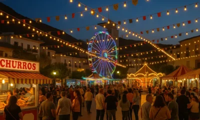
Albox Fair 2025: Full Day-by-Day Schedule and Concert Highlights

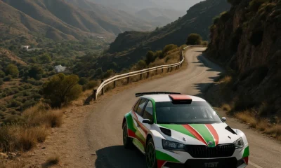
Rally Costa de Almeria 2025: 50th Anniversary Edition Kicks Off in Style

Almeria Airport Winter 2025: New UK Routes Boost Flights by 12%

Almeria Property Prices 2025: Vera Leads Andalusia with Record 72.9% Rise

Almeria AVE Station: Underground Rail Hub to Transform the City by 2027

All Saints Fair in Albox Begins Today

How the Garrucha Red Prawn Festival Boosts Tourism and the Local Economy

Almeria Earthquake: 4.2-Magnitude Tremor and Aftershocks

Almeria City Guide. Discover Almeria City — Culture, Cuisine, History & Mediterranean Life

Alicun Guide. Discover Alicun, Almeria — Nature, Heritage & Valley Tranquillity
Almeria Property Prices 2025: Vera Leads Andalusia with Record 72.9% Rise
Published October 31, 2025 | Category: Real Estate & Economy TL;DR: Vera tops Andalusia’s housing market with a record 72.9%...

Almeria AVE Station: Underground Rail Hub to Transform the City by 2027
Published October 31, 2025 | Category: Infrastructure TL;DR: The new Almeria AVE station and underground rail integration are progressing steadily,...

How the Garrucha Red Prawn Festival Boosts Tourism and the Local Economy
Published October 30, 2025 | Category: Real Estate & Economy TL;DR: The Garrucha Red Prawn Festival 2025 attracted thousands of...


Almeria province real estate – 42 homes for sale from €12,900 by Solvia
Published October 23, 2025 | Category: Real Estate & Economy TL;DR: Solvia, Banco Sabadell’s property agency, is offering 42 homes...
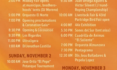
Albox Fair 2025: Full Day-by-Day Schedule and Concert Highlights
Published November 1, 2025 | Category: Events TL;DR: The Albox Fair 2025 is underway with five days of concerts, tradition...
Almeria City Guide. Discover Almeria City — Culture, Cuisine, History & Mediterranean Life
Published October 27, 2025 | Category: Travel Tips TL;DR: Almeria City is where the desert meets the Mediterranean — a...
Alicun Guide. Discover Alicun, Almeria — Nature, Heritage & Valley Tranquillity
Published October 23, 2025 | Category: Travel Tips TL;DR: Alicun is a peaceful Andarax valley village in Almeria, known for...

Alhama de Almeria Guide. Thermal Springs, History & Valley Life
Published October 23, 2025 | Category: Travel Tips TL;DR: Alhama de Almeria is a historic thermal-spring village in the lower...
-

 Almeria News2 weeks ago
EasyJet launches new Liverpool–Almeria flight
-
 Events2 weeks ago
Albox All Saints Fair 2025 — Five Days of Music, Food & Tradition
-
 Almeria News2 weeks ago
Rally Costa de Almeria 2025 — 50th Rally: Route, Timetable & Entries
-
Real Estate & Economy6 days ago
Almeria Property Prices 2025: Vera Leads Andalusia with Record 72.9% Rise
-
 Travel Tips2 weeks ago
Alhabia Guide. Discover Alhabia, Almeria — Valley Life, History & Scenic Walks
-
 Almeria News7 days ago
All Saints Fair in Albox Begins Today